Services
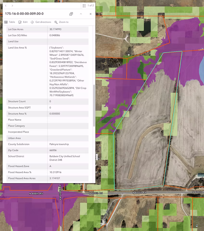
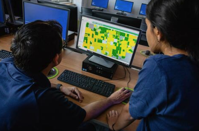
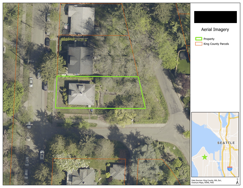
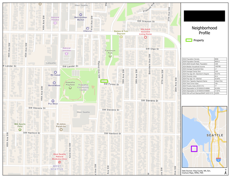
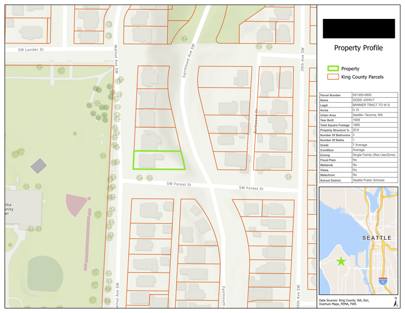
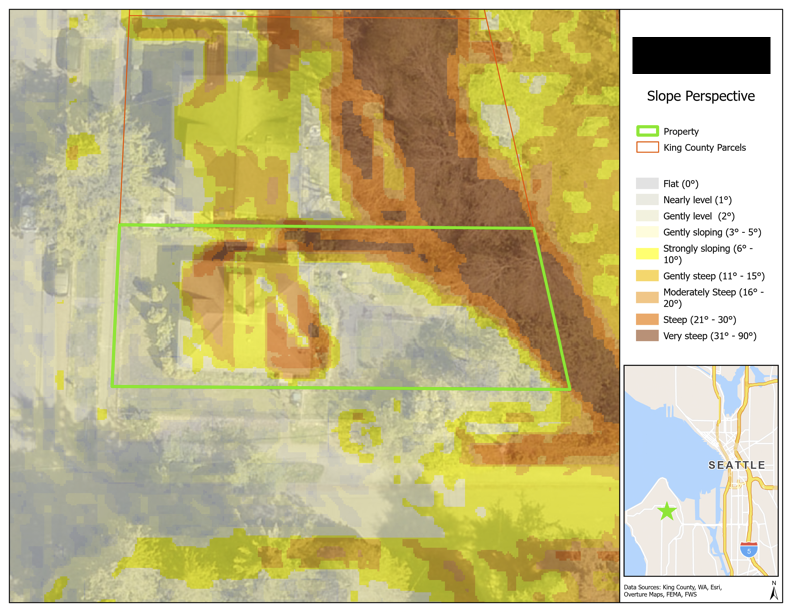
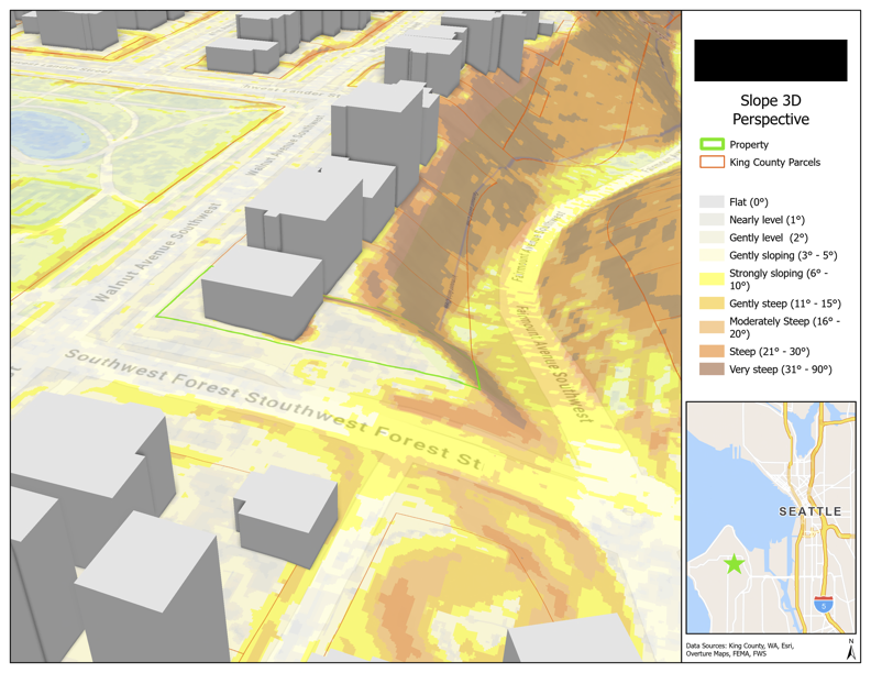
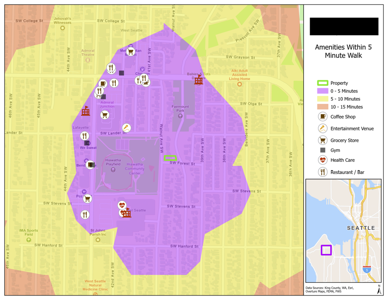
Parcel Scope
A specialized real estate service that helps clients identify and evaluate properties tailored to their specific needs. We deliver actionable insights and ranked opportunities. Whether the goal is land acquisition, development, conservation, or investment, Parcel Scope provides a data-driven approach to finding the right parcels, faster.
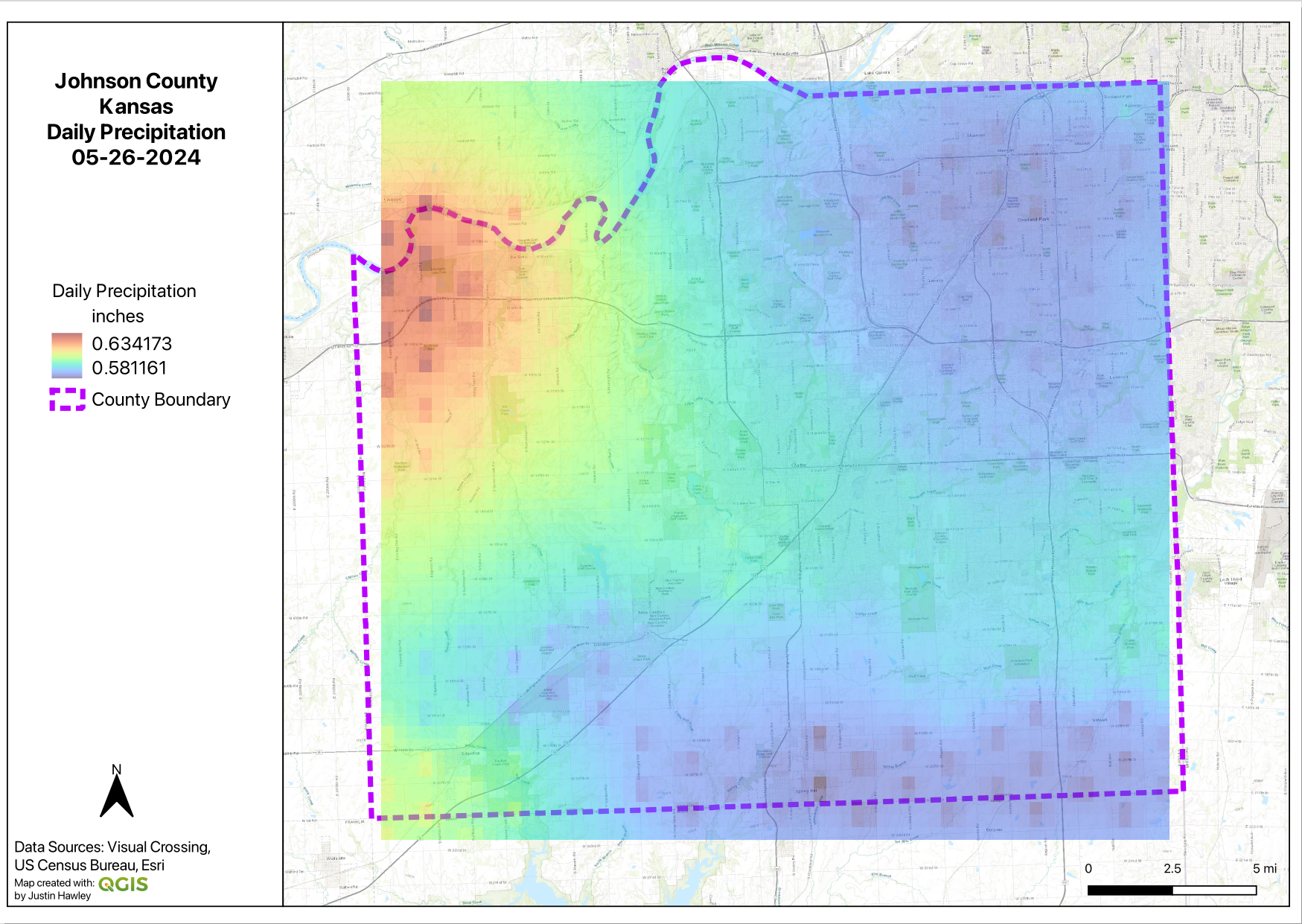
Field Data Collection & Aerial Surveying
We provide high-accuracy field data collection services using GPS and drone technologies to capture the spatial data you need—fast, precise, and ready for analysis. Whether mapping infrastructure, validating parcel boundaries, or generating up-to-date basemaps, our field services bridge the gap between the physical world and your digital GIS.
Full Stack Development
We design and build custom, end-to-end GIS applications that empower organizations to visualize, analyze, and interact with geospatial data in real time. From backend spatial databases and APIs to interactive front-end map interfaces, our full stack solutions are built for performance, scalability, and usability.
GIS Staff Augmentation
Expand your team’s capabilities with specialized GIS expertise. Unlike traditional staffing firms, GIS is our core competency. When you augment your team with our professionals, you're not just hiring individuals; you're gaining access to a robust internal network of GIS experts who collaborate, problem-solve, and share knowledge behind the scenes.
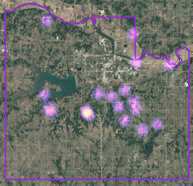
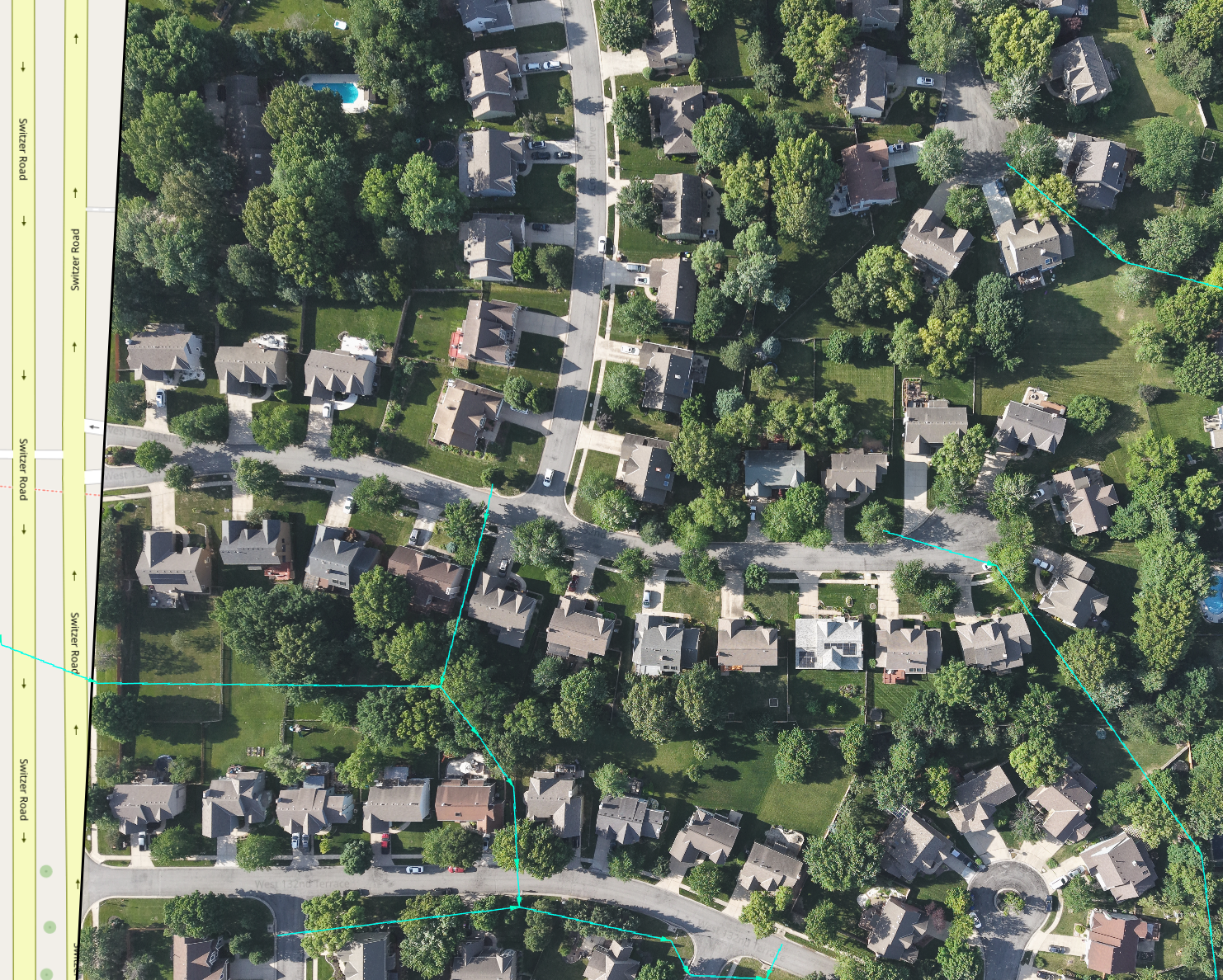
Gallery
About
OrcaTech provides innovative technology solutions to support today’s diverse customer needs. Inspired by the orca—known for intelligence and cooperation—we value teamwork and strategic problem-solving. We build minimalist, reliable, and user-friendly GIS systems.

Justin Hawley
GIS Development & Analytics

Leif Gerchberg
Real Estate Research Analyst & Licensed Realtor